
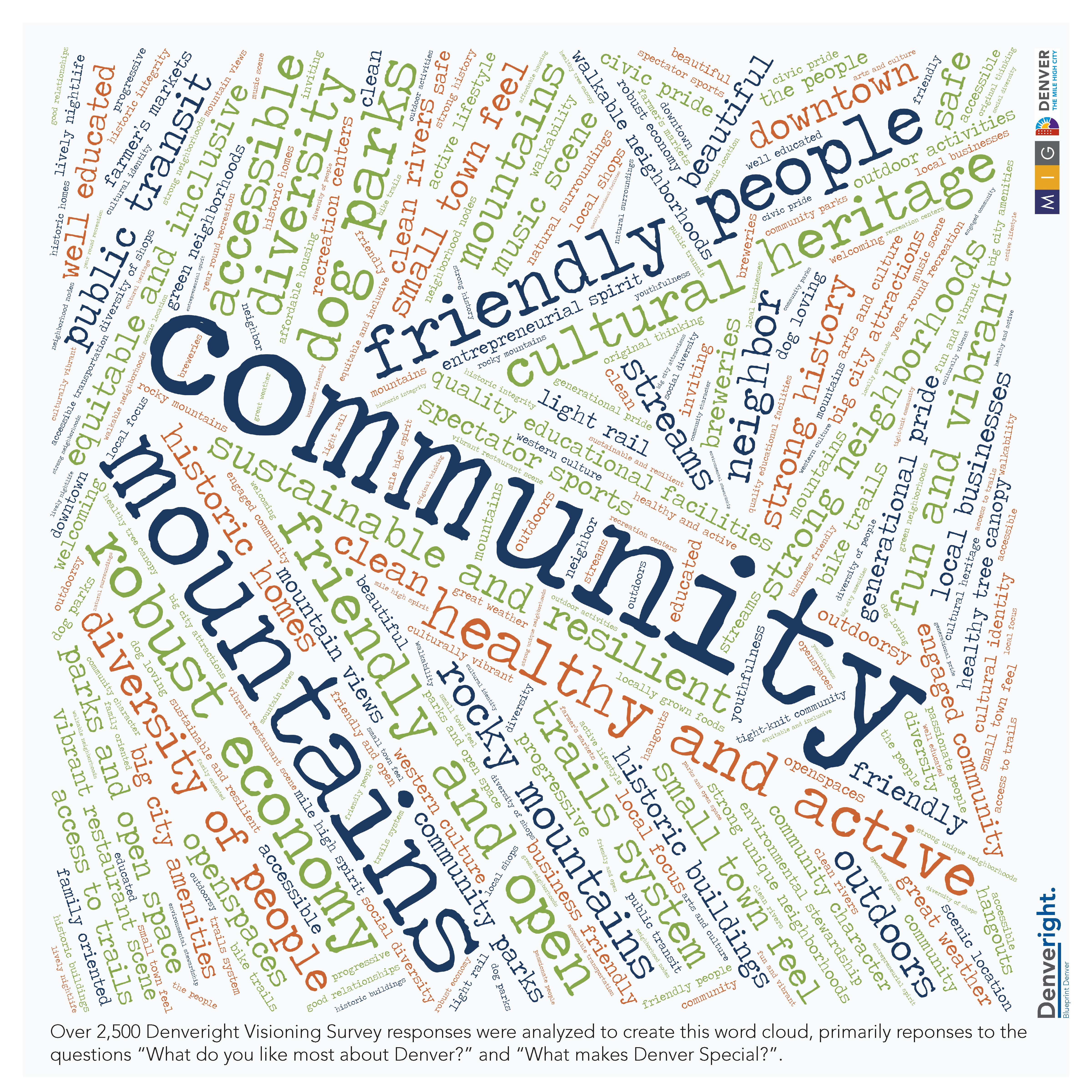
This word cloud was generated by citizen responses to a survey associated with the Denveright planning project.
—The traffic light timing around the Northfield area is horrendous.
—I attended a public meeting about a year ago and the city was hoping to take away the parking lane on the east side of Syracuse and turn it into a bike lane that would connect Lowry and Stapleton.
—There is a petition online where you can learn more about a grassroots effort to get sidewalks built throughout Denver so everyone has a safe place to walk
—Every bus stop should have a trash can and employees to maintain those facilities.
Posts on Nextdoor show Denver residents are regularly observing things that would make Denver a better place. Now Denver has launched an unprecedented policy-making project inviting residents to get involved in “Denveright.” The effort aims to update or create master plans in four areas simultaneously: land use, transportation, parks and recreation. The project was announced in May and is scheduled to conclude with City Council plan adoption late next year.
The effort is driven by growth, both recently and projected. Since the year 2000, Denver has seen its population increase by 23.3 percent. A recent report by American City Business Journals ranks the Denver metro area ninth in the country for growth projected in the coming quarter century with the Denver-Aurora-Lakewood region growing from a 2015 population of 2,814,330 to a 2040 population of 4,288,189—a change of 52.4 percent.
Growth Brings Change
All this growth brings change, some of it painful. A recent Denveright community workshop revealed resident concerns with looming big city challenges: deteriorating infrastructure, traffic congestion, a growing homeless population, affordable housing challenges and a loss of diversity as lower-income residents get priced out of Denver, and fears of losing neighborhood character as density increases.
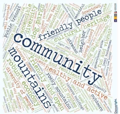
This graphic, shown at Denveright community meetings, illustrates the percent of owner occupied households in Denver.
Denver last updated its land use and transportation master plan (Blueprint Denver) in 2002. The signature idea in that plan was designating “areas of stability (AOS)” and “areas of change (AOC).” The goal was to direct growth to Areas of Change. AOCs constitute 20 percent of Denver land area and accommodated 54 percent of total housing unit growth in the city from 2002 through 2014, far less than the 85 percent goal. Denver dwelling unit growth was reached four years before projections; i.e., 2020 forecast numbers were achieved by 2016.
So much growth has occurred that Stapleton has morphed from an AOC to an AOS in 15 years. The Denveright website declares, “Denver’s rapid growth underscores the need for an updated land use and transportation plan to ensure we’re directing growth to the right places while protecting stable neighborhoods.”
The Four Phases of Denveright
The project is in the first of four phases—the kick-off with the emphasis on organization and issue identification. Phase 2, analysis and goals setting, will carry forward to next February. Next spring, phase 3 begins: development of preferred growth scenarios and project recommendations. The project concludes with phase 4 in the fall: City Council adoption.
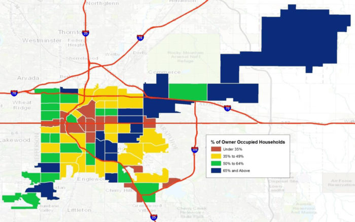
The Denveright project is developing a “community profile” of Denver, including this map illustrating “retail amenities” by neighborhood . On a square footage basis, the Stapleton area is well served.
Denveright Outcomes
Formally, Denveright is updating Blueprint Denver, the 2002 citywide land use and transportation plan, and The Game Plan, the 2003 citywide parks and recreation master plan. It is also tasked with creating Denver Moves: Transit, a new mobility plan for transit in Denver, and Denver Moves: Pedestrians and Trails, a new mobility plan for sidewalks, crossings and trails.
“Lowryright”
The Lowry Redevelopment Authority (LRA) recently followed a similar process to develop the Lowry Mobility Study, a project of the LRA that assesses the current and planned multi-modal network at Lowry along with recommended improvements. “Lowry was carefully planned as a walkable, bikeable, transit-served community from the beginning,” said Hilarie Portell, public relations director. “But with the city’s rapid growth, and community concerns about traffic congestion, we wanted to make sure we addressed any gaps and positioned the area for long-term mobility enhancements.”
The LRA has shared the document with the city, suggesting it as a model for mobility planning for a large neighborhood. Denver staff said they would be receptive to a similar effort in Stapleton, which mirrors Lowry’s situation as a large master-planned community nearing buildout.
__________________________________
Facts for Thought
—Denver land area: 153 sq. miles
—Population: 682,545 (2015 census estimate)
—Population increase: 23.3% since 2000
—By 2020: 20–25,000 more dwellings projected
—A “community profile” puts Stapleton into the highest
category among Denver’s 78 neighborhoods for:
• Park acreage per thousand residents
• Retail amenities
• Homeownership
–That same profile places Stapleton
in the lowest category for tree coverage.
–The 2002 Blueprint Denver plan says new development
will be directed to three general areas:
• Downtown
• Lowry, Stapleton, and Gateway
• Areas where land use and transportation are closely linked,
i.e., major arterials and rail transit stations/corridors
–Blueprint Denver forecast 15 percent of 2020 growth (housing, jobs) to Areas of Stability
and 85 percent to Areas of Change (AOC).
• Actual capture by AOC’s ranged from 50 to 65 percent, meaning Areas of Stability grew
much more than anticipated. This is one reason that rezonings and “character preservation”
have become dominant themes in established neighborhoods.
_____________________________________
How to Participate in Denveright
- Read project materials on the Denveright web site: http://www.denvergov.org/content/denvergov/en/denveright.html
- Attend meetings of the task forces created for each plan (meeting dates are in the project calendar on the website).
- Attend quarterly meetings of the “Community Think Tank,” which was created as a super committee to oversee the entire process.
- Sign up for the project newsletter.
- Participate in periodic on-line surveys.