Sarah McGregor
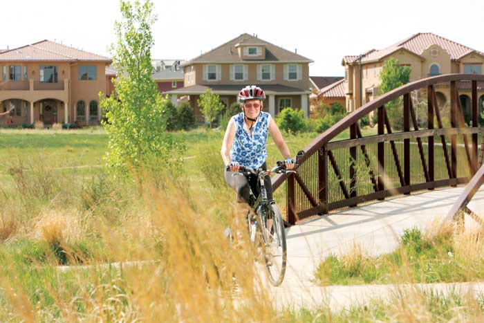
Equipped with a trailer for groceries and library books, Stapleton resident Sarah McGregor bikes anywhere possible. She has been biking for 45 years. Her favorite ride is the High Line Canal, which is family friendly. “The beauty of it is that you can go any distance. The canal is 60 miles long. We usually go 10 miles in and 10 miles back. And there’s not much bike traffic.”
McGregor encourages bikers of all levels to pick up a Denver Bicycle Touring Club map of the best routes in the Denver metro area. “Having biked in several other cities, I can tell you it is probably the best city bike map in the country,” she says. There is almost always a less busy and more pleasant route a few blocks parallel to major streets, she says. The map is available at most bike shops.
The Stapleton Area Transportation Management Association (TMA) promotes walking, biking, carpooling and public transit. To help get started with biking in NE Denver, TMA Association Outreach Coordinator Eric Herbst has compiled a list of suggestions for where to begin (and end for that matter).
By Eric Herbst, Stapleton TMA
Family Rides:
Greenway/Trail Ride
Distance (approx. round-trip): 5–10 miles
Difficulty: Easy
Description: Westerly Creek Greenway Trail splits Stapleton right down the middle making it convenient for almost anyone in the area. From Park Hill, head west on 26th or 23rd Ave. to Stapleton’s Greenway Park just east of Syracuse St. After exploring Westerly Creek to the south, head north toward Central Park—one of Denver’s largest parks at approximately 80 acres. After Central Park, continue north to the Sand Creek Regional Greenway and head northwest into Northfield/Conservatory Green. Easily head back to Westerly Creek on 26th Ave. or back the way you came.
Retail Ride
Distance (approx. round-trip): 5–10 miles
Difficulty: Easy
Description: Explore NE Denver retail areas starting at the Stapleton E. 29th Town Center where you can stop at restaurants, a bike and skate shop, and The Hub to grab free bike maps. Carefully cross Quebec, and head west on 29th Ave. Ride about 1 mile to Fairfax St. and turn left. This block offers restaurants, a cross-fit gym, and ice cream and coffee shops. If your bike needs repair, stop at Bike Depot, a nonprofit with a free bike repair station. At the end of the block, turn right and go west on 28th Ave. to Dexter. Turn left and go to 23rd Ave., which has Spinelli’s Market, a book store, restaurant and local coffee shop. Head east on 22nd Ave. for almost 1 mile until Kearney St., home to Cake Crumbs, the Art Garage, a bike store, outdoors shop, pet store, and gymnastics and yoga studios. Go east on 23rd Ave. to Oneida St., which has a veterinary clinic, laundromat and restaurants. Cross Quebec St. at 23rd Ave. and turn left on Syracuse St. to return to the E. 29th Ave. Town Center.
 Explore City Park
Distance (approx. round-trip): 5–10 miles
Difficulty: Easy
Description: City Park is accessible by bike from almost anywhere in NE Denver via 17th Ave. up to 26th Ave. One of our favorite routes is between 19th and 22nd avenues on Montview Blvd., which has a great bike lane and is lined with beautiful homes. Once reaching City Park, visit the Museum of Nature and Science, Denver Zoo, City Park Golf Course, or enjoy the abundant grassy space with a book or Frisbee. Jazz in the Park every Sunday in the summer is one of our favorite bike ride activities.
Public Facilities Tour
Distance (approx. round-trip): 15–20 miles
Difficulty: Easy
Description: NE Denver has a variety of public libraries and recreational centers. This ride is a way to visit all of them. Begin at the Park Hill Library off Montview Blvd. and Dexter St. Go east to Holly St. and head north to Holly Square at 33rd Ave., which has the Pauline Robinson Library, Hiawatha Davis Jr. Rec Center, a post office, and the Boys and Girls Club. Go east on 35th Ave. until Newport St. Turn left and visit Martin Luther King Jr. Rec Center. Go south on Pontiac St. (just east of MLK Jr. Park). Turn left on MLK Jr. Blvd. (Currently, the bike lane ends at Quebec St., but they are extending it to Central Park Blvd. in May. Ride through Stapleton to 25th Ave. and Havana St. and stop at Moorhead Rec Center. Continue to 26th Ave. At Syracuse, turn right and end at the Sam Gary Public Library.
Direct to Downtown
Distance (approx. round-trip): 15–20 miles
Difficulty: Moderate (more traffic interaction)
Description: Biking can be a great option for spending time downtown. 23rd or 26th Ave. or MLK Jr. Blvd. are some of the most direct routes from NE Denver. All of these routes have bike lanes or bike sharrows for most of the ride. Because of downtown’s diagonal grid, these routes can be a little confusing. 23rd Ave. runs into Park Ave.—not the best route if you want to go directly into downtown. 26th Ave. turns into 27th Ave. after crossing Welton St. (remember to look both ways for the Light Rail) but just continue on to Champa St., which heads downtown and provides another bike lane. MLK Blvd. is also a good route with a bike lane. After Downing St., turn onto Champa St. Confluence Park, where the South Platte River and the Cherry Creek come together, is one of our favorite downtown visits.
More Serious Rides:
Creek/River/Creek/Canal Loop
Distance (approx. round-trip): 40–45 miles
Difficulty: Moderate
Description: Ride a giant loop around Denver by way of trails and minimal roads. Start on the Sand Creek Regional Greenway. Begin northwest to the South Platte River Greenway. Go southwest to the Cherry Creek Bike Path, southeast to the High Line Canal trail and northeast back to Sand Creek. This route includes paved, intermittent pavement, packed gravel and dirt. The trail goes through urban high-rises, industrial parks, neighborhoods and green open space. Specific attractions include: Confluence Park, Star K Ranch, The Urban Farm, and the Bluff Lake Nature Center.
Cherry Creek Reservoir Ride
Distance (approx. round-trip): 30-35 miles
Difficulty: Moderate
Description: Cherry Creek Reservoir is the closest large reservoir to NE Denver, which makes it a full-day destination. Begin on Syracuse St. and head south to 16th Ave. Turn left and go to Florence St. where you will head south. Continue on to Del Mar Pkwy to the High Line Canal trail. Go east to the Colorado Front Range Trail, which goes all the way to Cherry Creek Reservoir State Park. Plan extra time to enjoy the state park and a quick ride around the reservoir.
NE Denver to Golden
Golden offers many bike shops and restaurants along its main street (Washington). We suggest two routes—one more road-oriented and the other trail-oriented.
Road Route
Distance (approx. round-trip): 40–45 miles
Difficulty: Hard
Description: Begin west on MLK Jr. Blvd. to Champa St. At 15th Ave., head northwest across I-25 where 15th Ave. turns into 29th Ave. From 29th Ave., continue to 32nd Ave., which goes all the way to Golden, where you will arrive right behind the Coors Brewery.
Trail Route
Distance (approx. round-trip): 45–50 miles
Difficulty: Moderate
Description: The trail route to Golden is a little longer but avoids stoplights, stop signs and general car traffic. Begin at Sand Creek Regional Greenway Trail
and head northwest, where it joins up with the South Platte River Greenway. Head north until you reach Clear Creek Bike Path. Ride approximately 22 miles west. You will arrive on 12th Ave. that goes straight into the heart of downtown Golden.
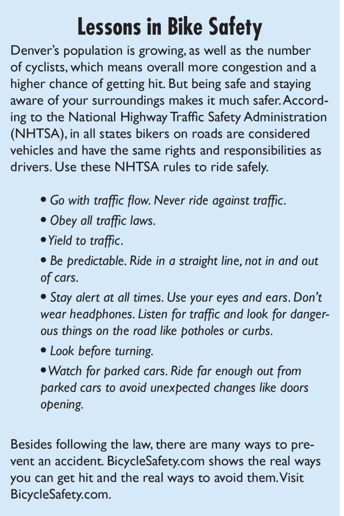
For detailed lessons in bike safety visit BicycleSafety.com.


0 Comments