


So close yet so far. That might summarize where things stand today with the Denver portion of the Sand Creek Regional Greenway trail. It’s located in the heart of Stapleton yet can feel wild and remote. It’s also tantalizingly close to completion after 20 years of development.
For several years now, construction projects have been opening and closing various sections of the four and a half mile Denver segment. Yet, this protracted time of user confusion will soon transform into a “new era,” said Kate Kramer, Executive Director of the Sand Creek Regional Greenway Partnership (SCRG). A master plan update is underway along with new capital investments and plans to seek funding to complete the trail through Stapleton.
The Front Porch has prepared this map and accompanying story to help users navigate the existing and future trail. Click here to see an enlarged version.
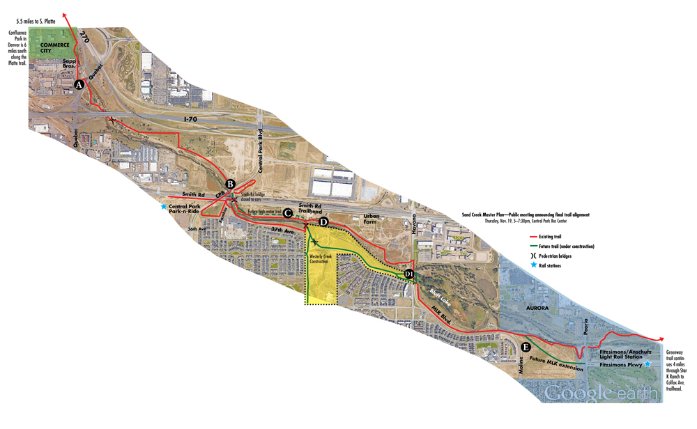
A. Quebec Interchange
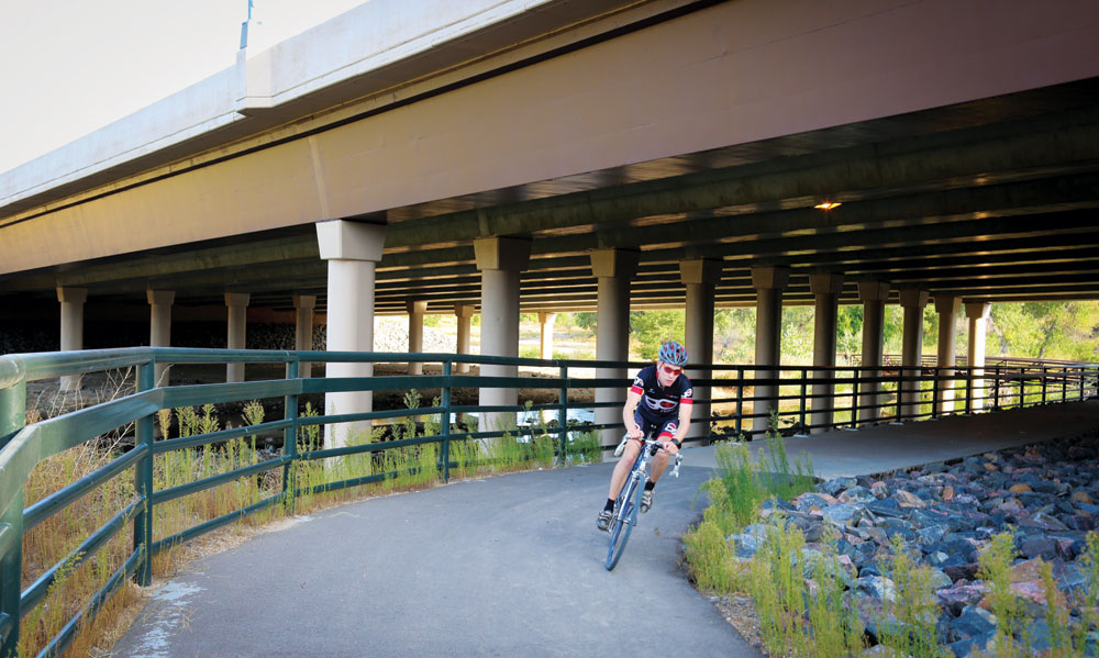
Proceeding upstream, the Denver segment of the Greenway trail begins at the Commerce City boundary near 48th Street and the Sapp Brothers Travel Center. This cyclist is heading west on the trail under I-70. The trail either side of the I-70/Quebec this interchange will be in an interim condition (i.e., asphalt) until the on and off-ramps associated with the I-70 East project are completed. CDOT is about to issue an RFP for that massive project and timing is still uncertain. The Greenway trail segment immediately upstream from I-70 has suffered severe scour from recent floods. The hydrology of this segment is under reexamination by the master plan update project consulting team led by Stream Landscape Architecture & Design. The goal is to install final trail improvements that will resist damage in future flood events. Suncor Energy has provided seed money that the Partnership and Denver Parks and Recreation will be trying to leverage into a complete budget.
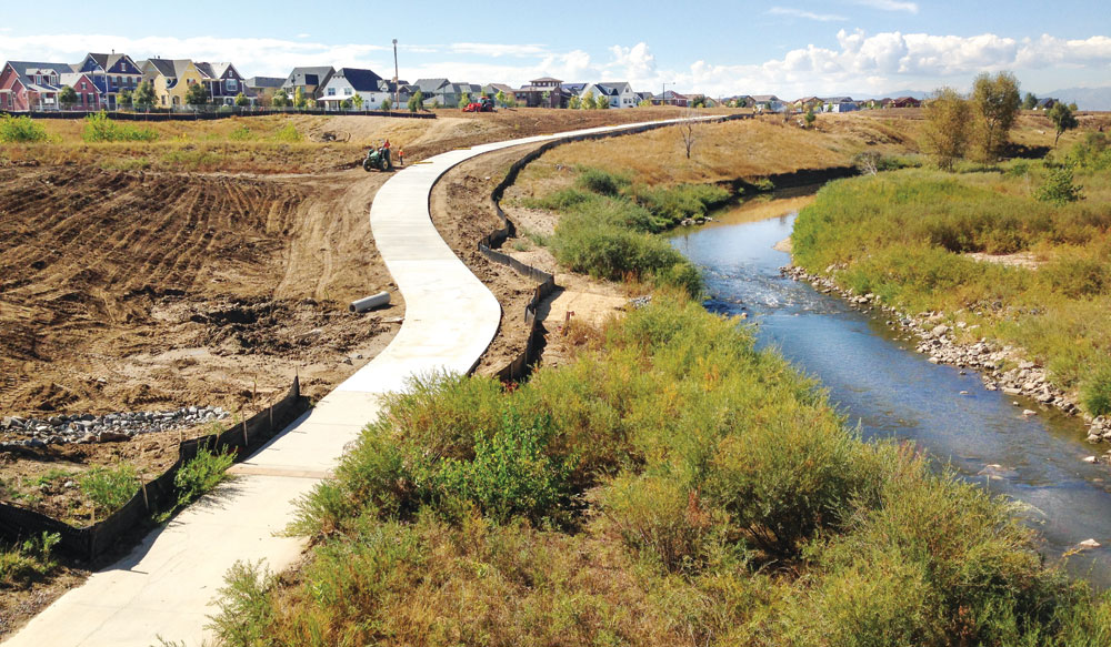
The permanent trail on the north side of Sand Creek from Central Park Blvd to the Smith Road trail head has been disrupted for the past several years by RTD’s FasTracks project. This fall, Denver Transit Partners will build a trail underneath Smith Rd. and two rail bridges, improving the safety and continuity of the trail at this important juncture. The trail that passes through the so-called “tunnels” area of the greenway (where Stapleton’s north-south runways used to cross over Sand Creek). Trail users can also access the new CPB transit station via Smith Road as it passes under the Central Park Blvd. bridge.
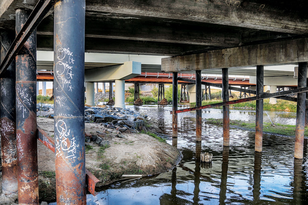
B. Three Bridges Trail Underpass
The permanent trail on the north side of Sand Creek from Central Park Blvd to the Smith Road trail head has been disrupted for the past several years by RTD’s FasTracks project. This fall, Denver Transit Partners will build a trail underneath Smith Rd. and two rail bridges, improving the safety and continuity of the trail at this important juncture. The trail that passes through the so-called “tunnels” area of the greenway (where Stapleton’s north-south runways used to cross over Sand Creek). Trail users can also access the new CPB transit station via Smith Road as it passes under the Central Park Blvd. bridge.
C. Tunnels Area
The name of this segment is somewhat of a misnomer. The tops of the tunnels where Stapleton Airport runways crossed Sand Creek were removed several years ago. The supporting walls on the north and south banks remain as does the concrete bottom underneath the creek that renders this stretch a shallow haven for waterfowl. The master plan study may recommend an alternative trail for use in high water. The current trail on the north side of the stream tends to flood in storm events. A parallel trail on the high bank north of the tunnel wall would provide safe passage during storms.
In the Uplands West area, the soft surface trail paralleling 37th Ave. is closed until approximately mid-November due to construction.
D. Confluence to Havana
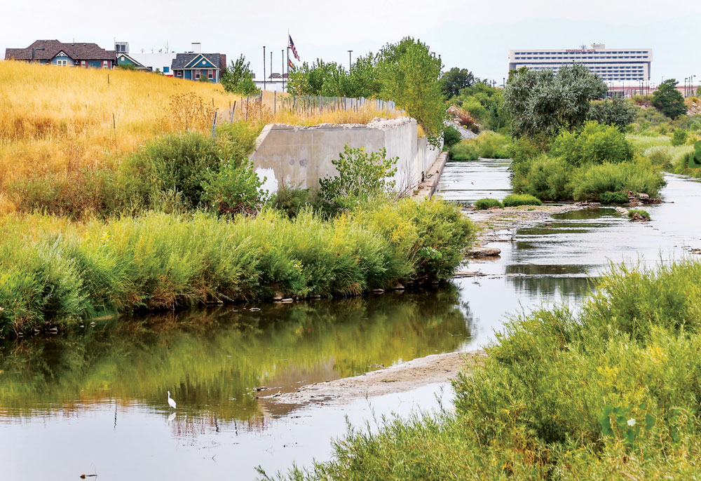
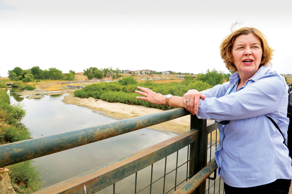
SCRG Executive Director Kate Kramer points to Westerly Creek’s confluence with Sand Creek from the bridge accessed at the Smith Road trailhead. A massive environmental remediation and park construction project has been underway this year to create the Westerly Creek North and Prairie Uplands Parks. A new bicycle/pedestrian bridge over Westerly Creek and a trail through the parks from Beeler St. to Havana St. will provide access to the south bank of Sand Creek, complementing the long-established Greenway trail on the north side of the waterway. This area will be open to the public next summer to allow the extensive revegetation to establish itself.
D1.
At the same time, the Havana trail underpass (photo D1) will be re-opened to allow trail users to continue east without having to cross the Havana/Florence Way intersection.
Completing the Trail
The Sand Creek Regional Greenway (SCRG) was conceived in the early 1990s, sparked in part by the abandonment of Stapleton Airport but even more by the successful transformation that had been occurring along the South Platte in Denver and its neighboring jurisdictions.
Just as redevelopment of Stapleton began with a vision (described in the so-called “Green Book” master plan), so did the SCRG begin with a plan for a regional-scale amenity. By the mid-1990’s, Denver, Aurora and Commerce formed the Sand Creek Regional Greenway Partnership to transform a high plains creek corridor burdened by highways and industrial development. The goal was to not only allow the corridor to serve its flood conveyance function but to restore the landscape and create a regional recreation corridor.
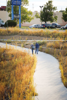
Sand Creek Trail users walk in the area west of the Quebec Bridge.
The Greenway was defined as extending the 14 miles from Sand Creek’s confluence with the South Platte upstream to where the creek crosses Colfax Avenue in Aurora. Hard and soft-surface trails were to be constructed for use by hikers, bikers and equestrians. Over time, debris left over by the numerous industrial users along the stream would be removed and the riparian landscape restored. As expressed in the 1995 Greenway Master Plan, the vision was to balance access with preservation of the stream corridor.
What set the Denver segment apart from the corridor in the adjacent cities is that much of the land was owned by Denver Aviation because it lay within the boundaries of the Stapleton International Airport. While public ownership of land needed for a public facility is generally a good thing, in this case, trail completion was delayed by environmental remediation and Denver’s reluctance to take on ownership and maintenance of a new facility at a time of budget constraints.
During all this, the SCRG Partnership has persevered in securing funding for a basic trail to make sure the Denver segment was not the missing link. From the Quebec Street interchange to the Aurora city limits just west of Peoria Street, the trail has always connected to Aurora and Commerce City, interrupted only by its alternating surface materials – concrete, gravel and dirt.
Master Plan Update
Now that land ownership by Denver Parks & Recreation is imminent, the city has undertaken an update to the 20-year-old greenway master plan using a $75,000 grant from Great Outdoors Colorado (GOCO). With cash contributions from Denver and the SCRGP, the total project budget is $125,000. Project manager Jay Henke of Denver Parks & Rec says the focus will be on determining a final alignment for the trail and then proceeding to prepare construction documents. Those “CDs” will put Denver and the Partnership in a better position to compete for trail construction grants and to solicit private and foundation contributions. Final trail design will also be able to take into account lessons learned from flood events in recent years.
The master plan study will not address overall landscape restoration or other issues such as a long-term weed management plan. However, as the Denver segment becomes more integrated into the Denver park system, trail advocates will be pushing to have those issues addressed by the city.
Safety
The new trail segments and the link to the Westerly Creek Park in the middle of Stapleton will inevitably attract more users. User safety of relatively isolated trails is always a concern. Kramer, who has been with the Partnership 10 years, says she is unaware of even a single criminal incident along the greenway during that period. She acknowledges the presence of some homeless individuals, a situation that peaks during the summer “hitchhiking season.” She believes the trail is safe but urges users to use common sense, for example, by not traveling alone at dusk. She said new structural designs inhibit camping under bridges. In addition, merely having more users, i.e., “eyes on the trail” will further enhance a sense of safety.
Greenway Role in Regional System
As the greenway matures, it will also grow in its role as a connector to a much larger regional system with these components:
- The South Platte, Highline Canal and Cherry Creek trails
- An eventual link to the Aurora Reservoir via the “Triple Creek” extension of the SCRG south from a new trailhead at Colfax Avenue, and
- As a connection to the Rocky Mountain Greenway envisioned as a complete off-road trail linking the Rocky Mountain Arsenal Wildlife Refuge, the Rocky Flats Wildlife Refuge and Rocky Mountain National Park. The Sand Creek Regional Greenway Partnership did its part by funding a temporary connection to the Arsenal Refuge.

0 Comments