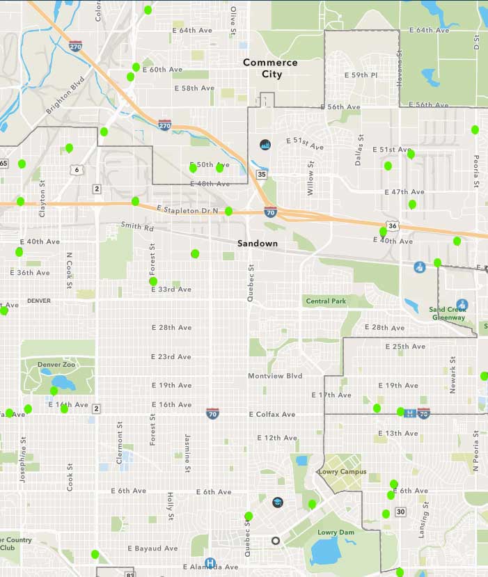
The state now posts a map showing Covid-19 confirmed outbreaks reported to CDPHE. It is updated weekly on Wednesdays at https://covid19.colorado.gov/covid19-outbreak-data. As can be seen in the attached map, few cases show in NE Denver east of Colorado Blvd.—most are in surrounding areas. We have added the green dots to make them more visible. On the actual map each dot can be clicked to find the date and other information about that case.
The state has also announced that an app will be forthcoming soon and people with iPhones will get a prompt to upgrade their operating system, then a prompt to enable Exposure Logging. People with Android phones will get the prompt in late September or early October. Learn more about the app at https://covid19.colorado.gov/Exposure-notifications#FAQ

The green dots show locations of confirmed Covid-19 cases. On the map website, you can click to get more information about each case.


0 Comments