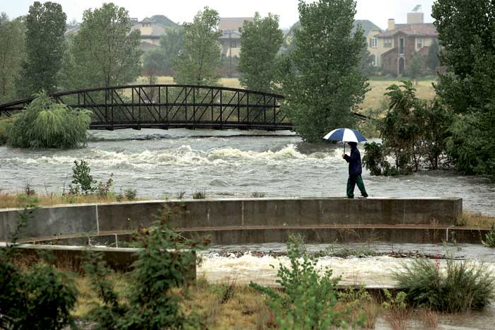
View looking south from about 29th Ave. of an onlooker walking along the drop structure as Westerly Creek roars by.
My neighborhood received as much rain as recently flooded most of northern Colorado—yet with no loss of life and little damage. As I watched storm tragedies unfold, it brought back memories of my California days. In canyon communities like Malibu and Topanga, torrential storms regularly immersed hippie-shacks and mogul’s mansions in mud slurries. As in Lyons, living in such narrow mountain valleys had tradeoffs; close community and idyllic scenery, but serious flood risk.
Such risk comes from living in a natural funnel. Mountains act as the cone-shaped mouth of the funnel, capturing and concentrating rainfall. In such areas, buildings and roads are flotsam poised to be swept away. Canyons act like a funnel’s narrow neck, delivering water to the floodplain and its eager rivers. In the process, water must gush through streams of foothill towns. Such storm-swollen waters recently reminded Boulderites why their “creek” is so darned bouldery. It’s because the creek is periodically a raging river—one that flushes smaller sand and mud-sized sediment out to the plains, leaving big rocks and rolled boulders behind. On natural floodplains, like in Greeley, high ground is the place to be, because rivers overtop their banks. Most rivers do this regularly, with muddy floodwaters delivering sediment to floodplain soils. This flooding process is what created most of these arable soils in the first place.
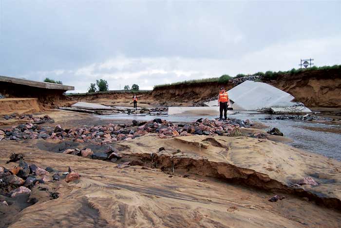
Rocky Mountain Arsenal employees assessing damage beneath the Havana spillway after the storm.
Our infrastructure and modification of the landscape intensified the storm’s impact. For example, many dams and roadways, whether intended to hold stormwater or not, ponded storm waters and then failed catastrophically. Natural processes like wildfire and beetle-kill also intensified rainstorm effects. Healthy forests serve as sponge-like buffers between where rain falls, and where it collects. Where forests were burned and crippled, they were less able to mollify deluges.
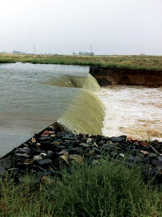
he spillway for the Havana Ponds at the Rocky Mountain Arsenal beginning to give way early on Sept. 12.
Despite these scientific factors, human experience is often what shapes disaster planning and response. And here on the Front Range, we’re wet behind the ears—we’ve only got 150 years’ experience with flood disasters. Without exposure to once-in-a-millennium storms, our patterns of development often creeps waterward during times of calm. Scenic foothill homes, canyon hideaways along babbling brooks, and ranches on fertile fields become established. Supporting infrastructure grows, and a generation passes without witnessing nature’s wrath. Once communities are established, our financial and emotional ties to the land dissuade us from moving or modifying. Witness New Orleans, the site of our nation’s most tragic recurrent natural disaster.
Some newer communities in Colorado are faring better than those of old, especially where urban spaces are planned with drainage and historic flood patterns in mind. For example, in my decade-old neighborhood the parks, playgrounds and trails create contiguous green spaces bordering waterways, snaking under bridges and betwixt neatly arranged homes. These “soft surfaces” await their moment to flood when they’ll become a spongy arterial system. In the recent deluges, they did just this—swelling, spreading, absorbing and diverting water to larger outlets. Most importantly, they minimized impacts of surging waters on homes, schools, businesses and roads.
Pedestrian bridge just east of the I-70 underpass on Sept. 16.
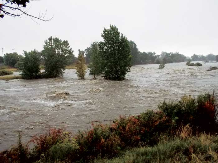
At the drop structure along the Sand Creek Regional Greenway east of the Dahlia trailhead on Sept 12.
But what about the future? The answer lies in the past, because in Colorado we have abundant geological evidence of ancient mega-torrents—many of which shaped and left telltale scars on our landscape. Such clues from the past permit us to know the scope of potential future events and to strategize infrastructural changes that accommodate 100- and 1,000-year storms. Our inhabitation of funnels and floodplains demands that we use such evidence and plan for such events. Especially because our “once in a millennium” deluge can happen at any time—two years from now, 20 years from now, or beyond. A “once in a millennium” rainfall occurs on average once per thousand years but doesn’t mean we have 999 years ’til the next one.
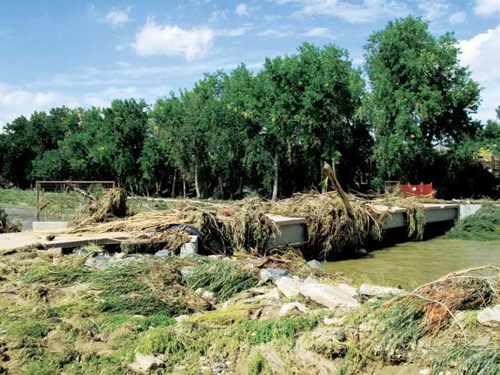
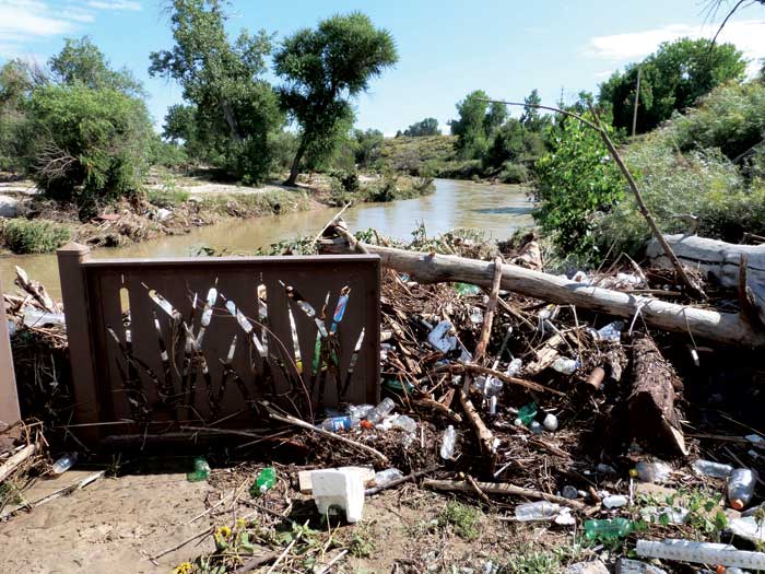
Pedestrian bridge over Sand Creek near the Commerce City Wetland Park on Friday Sept. 13.
So next time you’re sipping java or savoring microbrews in funnel-towns of Morrison or Golden, remember their kindred spirits—Boulder, Lyons and Manitou Springs. Each one has been devastated by recent deluges, and they presage what may be next.
James W. Hagadorn, PhD, is a scientist at the Denver Museum of Nature & Science. Suggestions and comments welcome at jwhagadorn@dmns.org.


0 Comments