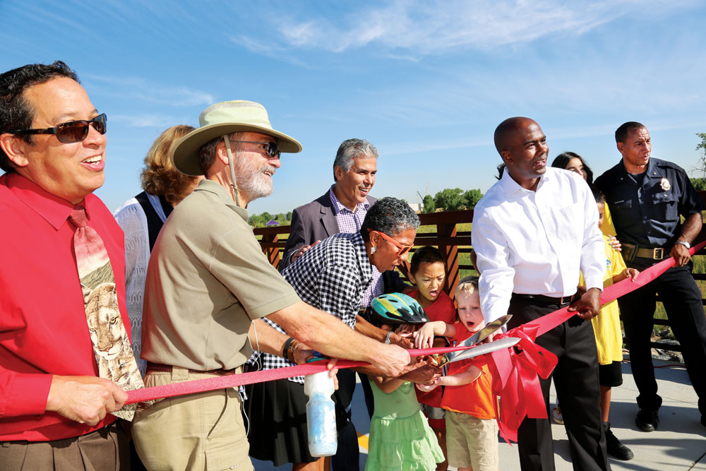
Denver officials and neighbors celebrate the opening of Westerly Creek North open space at a ribbon cutting ceremony on Aug. 17.
The recent Westerly Creek North ribbon-cutting ceremony marked a major milestone in the evolution of Westerly Creek as a greenway connecting Lowry to Stapleton. The transformation of the 8,000-foot span of the creek within Stapleton has been dramatic. This long-abused waterway is slowly being daylighted (re-established into an above-ground channel).
What used to be a 108-inch diameter water pipe under airport runways is now an open channel, offering flood control, water quality control, park land, open space, regional trails and wetlands, and it is the site of ever-increasing activities including the Big Wonderful festival. It also serves as a highly desirable backdrop to Stapleton’s residential development. With the opening of Stanley Marketplace this fall, its economic influence expands to commercial uses.
Here is a brief rundown on the various projects that are literally re-shaping Westerly Creek:
Westerly Creek North Officially Opens

The confluence of Westerly Creek with Sand Creek is visible in the background.
Westerly Creek North was the last of the three segments of Westerly Creek in Stapleton to be rehabilitated. Even when Stapleton was an airport, this portion of the waterway was not underground since it was located north of the east-west runways. However, it was full of concrete rubble, had some environmental contamination and jogged in unnatural 90-degree turns. The just-completed project added “sinuosity” or gentle curves for aesthetic reasons and to help stabilize the streambed. East-west and north-south regional trails were constructed and the stream banks were re-contoured, re-vegetated, and “armored” with riprap (rocks) in select locations to prevent erosion. A budget exceeding $11 million allowed expansion of the project to enable similar work on the “uplands” areas of Sand Creek between Boston and Havana streets. Originally scheduled for construction in 2008, the project was delayed by the recession and diversion of funds to construct Swigert Elementary School.
Westerly Creek Middle and South
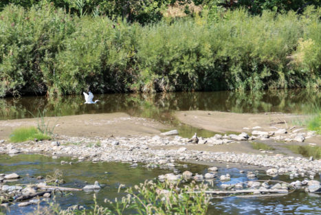
A great egret flies at the confluence with Sand Creek.
When Stapleton Airport closed and the runways were removed, creek designers and engineers were presented an unusual opportunity: a tabletop flat landscape within which to recreate a high plains stream. Further, because the creek had been forced into a pipe years ago, there were no restrictions under federal law. Normally, “waters of the U.S.” such as Westerly Creek, are regulated under the Clean Water Act, which has a strong bias against altering a natural drainage way. Says Robert Krehbiel, engineer of record with Matrix Engineering, “We had an open palette, if you will, to create a nice amenity.”
Designs that began in the late ’90s expanded the natural area beyond the floodplain, to a thousand feet in places. The dimensions grew largely out of sketches done for the Stapleton Development Plan (aka Green Book), which began with the premise that 1,116 of Stapleton’s total 4,700 acres would be open space. Westerly Creek comprises a large portion of that promised open space.
Early design choices included: reintroducing sinuosity to the creek alignment; dispersing wetlands rather than consolidating them at the confluence; reintroducing a natural landscape, i.e., native plants rather than bluegrass; creating a more gradual flow to prevent erosion; limiting night lighting; and softening the impact of the Central Park Recreation Center by limiting the building height and moving it downslope.
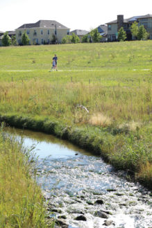
Gentle gradients in the streambed and side slopes minimize erosion in heavy rains.
“Early choices made this a success,” says Krehbiel. “Typically we are asked how much can we squeeze the floodplain to maximize development. It’s the vision of the site that kept it a wide corridor. Stapleton is one of the few places in the city of Denver that is designed for the 100-year flood. Most places are designed for 5- or 10-year floods and anything beyond that drains in the streets.”
Lower Westerly Creek Improvements
at Montview Blvd.
This project re-built the Montview Bridge over Westerly Creek to enable 100-year flood flows to pass under the roadway. The previous bridge and culvert design did not have this capacity, forcing water to back up during flood events. The project has removed 48 Aurora properties from the floodplain. The additional capacity was created both by enlarging the opening under the bridge and by deepening the channel about 1,000 feet north of Montview. A major side benefit of the project was the opportunity to connect Westerly Creek in Stapleton to Montview Park in Aurora through construction of a 10-foot-wide concrete path under Montview, which, effectively, extends the regional off-street path to 17th Ave. The $9 million project was funded by Aurora, FEMA and the Urban Drainage and Flood Control District (UDFCD).
Montview Park Reconstruction
Reshaping of Westerly Creek created an opportunity for Aurora to re-do this nine-acre park, which extends from Montview to 17th. The $1.2 million renovation is nearing completion and features extensive re-grading, a regional trail connection, new playground, picnic area, community garden and basketball courts.
New Freedom Park
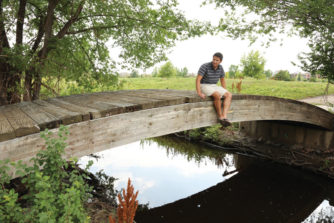
Loren Ting, a partner in the development of Stanley Marketplace, sits on a bridge over Westerly Creek where it flows by Stanley.
This 2.1-acre Denver park at 13th and Xenia opened in 2012. Features include an urban garden, soccer field, playground, sidewalks, trees and shaded seating area. The improvements serve a largely Asian refugee population. It was undertaken by Denver Parks and the Trust for Public Lands, with local nonprofit support, at a cost of $600,000.
Westerly Creek Greenway Restoration 11th–13th Avenues
The creek is daylighted in this two-block stretch but the restoration project will realign the trail to improve access and allow establishment of a “healthy riparian channel with wetlands, native uplands and a functioning floodplain.” The $1.86 million project is funded by Denver and UDFC. Construction begins this fall with completion in 2017.
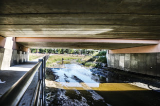
A new path under the reconstructed Montview Bridge allows users to cross Montview and continue on an off-road path to 17th Ave.
What remains to be daylighted?
Despite all these improvements, roughly half of the corridor length from 11th Ave. to Montview remains hidden underground beneath streets and buildings, interspersed with six separate open channel flow segments. Neither city, at this point, has budgeted additional funds to support more creek daylighting or trail development. However, both Denver and Aurora have signaled their intent to have this portion of Westerly Creek transform in the manner that has been accomplished in Stapleton.
Bike/Pedestrian Access from Lowry to Stapleton
Denver’s adopted bicycle master plan shows numerous recommended improvements such as bike lanes on Yosemite St. but no timetable for implementation. For the time being, the use of relatively quiet side streets, such as Uinta or Chester, may be a non-motorist’s best way to navigate from 11th to Montview. Whichever street is chosen, the walker or biker is still confronted with crossing Colfax Ave., while Westerly Creek flows underground, undisturbed in a huge pipe.
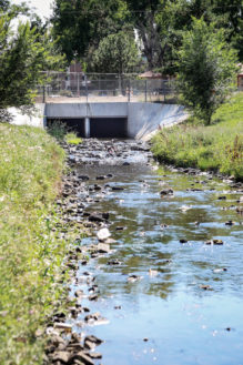
Westerly Creek emerges from an underground pipe at 17th and Beeler. Much of the stretch upstream between here and 13th Avenue is underground.
Water Quality
In terms of water quality, the two existing dams in Lowry (Westerly Creek Dam near Alameda Ave. and Kelly Rd. Dam near 11th Ave.) help create good quality base flows in the creek although the stream is listed as “impaired” by the Colorado Department of Health and Environment in terms of E. coli and selenium. According to CDPHE’s Sarah Wheeler, such conditions are not unusual for urban streams. Recreation in the stream such as swimming, with its potential for ingestion, is not recommended. Wheeler suggests washing of hands and face after contact with stream water.
Park Management
Westerly Creek North and the Uplands add 64 acres to Denver’s park portfolio. In Stapleton, the parkland will be managed by Denver Parks & Recreation, i.e., no off-leash dogs. Denver Public Works will maintain the storm management features in collaboration with Urban Drainage.
Westerly Creek – it’s Not Just Beautiful, It’s Functional
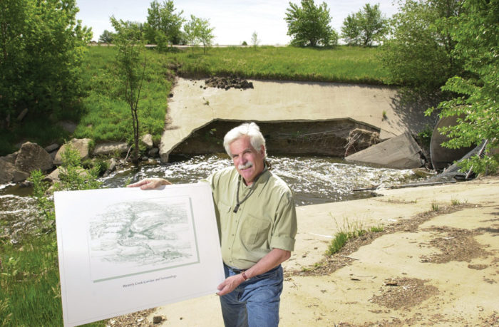
Dennis Piper who served as the Stapleton Development Corporation’s Director of Parks and Environment full time for 10 years beginning in 1998, says “Westerly Creek is one of the best things at Stapleton, an incredible success as a natural area and as a design that reduces erosion. Several times it has handled way more than the hundred-year flood.”
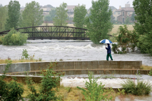
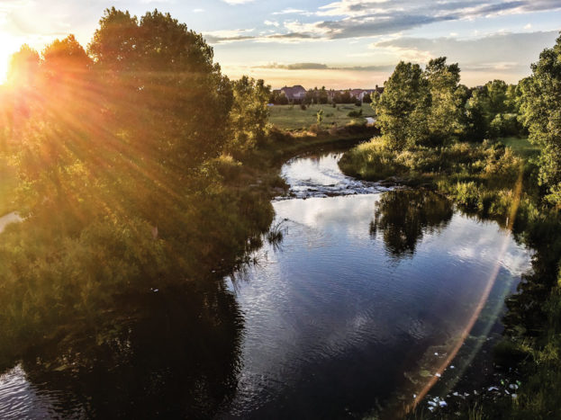
Westerly Creek just before sunset at the 26th Ave. bridge.


0 Comments