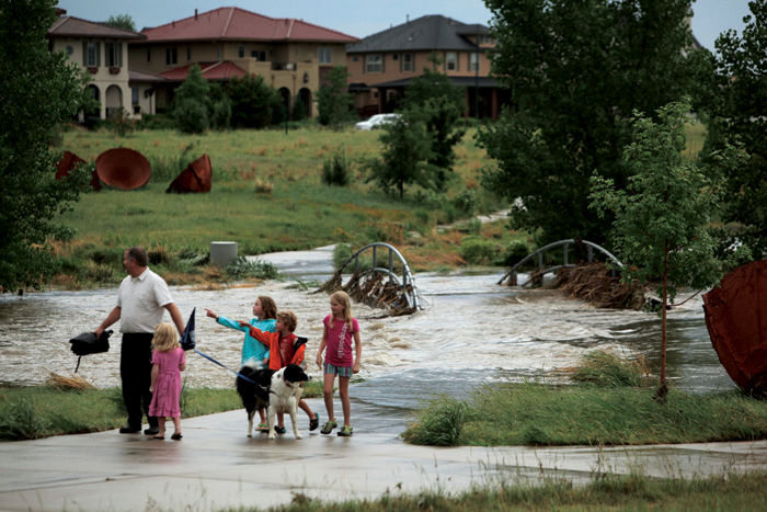
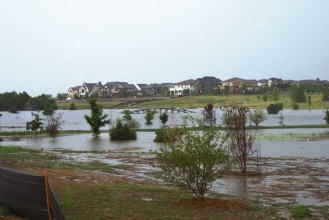
The Dezoeten family checks out Westerly Creek after the rain stopped and the water was receding.
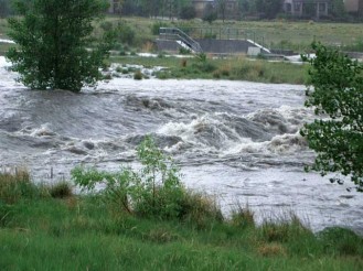
After the big flash flood on July 7, the Front Porch asked Forest City Senior V.P. Charlie Nicola how the grand plan for Stapleton drainage had worked. “All the systems have worked beautifully,” says Nicola. “The streets in Stapleton have remained dry. Westerly Creek itself becomes a flood zone, but it’s doing its job in detaining water and conveying it downstream as it’s supposed to.”
“I am involved with all areas of Stapleton, but I live right at the edge of Westerly Creek so this is obviously important to me personally as well.
“Prior to our involvement, Westerly Creek was hidden from view. It ran through a 108-inch diameter pipe from the area around Stanley Aviation (near Montview) almost to Sand Creek. So early on we commissioned Matrix Design Group to do a drainage study and we worked with other design team members to look at how we could make Westerly Creek the natural and usable area it is today.”
Nicola explains that Westerly Creek is a collection point for the “outfalls,” the storm water flowing into it from both the east and west. The land from the former airport was flat. A lot of earthwork was required to grade it so the water would flow into Westerly Creek from both directions. Basically Stapleton was graded into a V shape, with Westerly Creek being the low point. “So it’s nice to have a blank slate, but at the same time being so flat raised a lot of challenges,” says Nicola. “Westerly Creek itself was a large earthwork project where there was considerable excavation in order to turn it into the park it is today and to provide the areas for the outflows in accordance with state and federal clean water regulations.” But in making it a user-friendly park area, Nicola points out that they couldn’t change the bottom of the creek, “federal permits required us to maintain the elevation of the creek itself.”
Westerly Creek has a very broad shallow floodplain defined. Much of the park corridor is within the 100-year floodplain. The designers utilized this wide corridor to carefully manage flood events over dense deep-rooted native vegetation without the need to use a lot of exposed rock to stabilize the channel. The intent was to avoid having Westerly Creek look like an engineered channel.
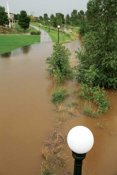
The east-west Greenway, with plants that help catch debris and “urban drool.”
Nicola explained that current design criteria elsewhere in the City is to manage the 2-year to 5-year storm water underground with the remainder carried in the streets. However, much of the City’s older storm drain system constructed prior to current criteria has less than a 2-year capacity. The Stapleton drainage system was specifically designed to a higher standard to handle a 100-year storm event.
“All the storm waters in Stapleton find their way to Westerly Creek and the water is detained in such a way that it doesn’t overstress any of the facilities downstream, such as Sand Creek,” says Nicola. “At the outfall, where the storm drain system flows into Westerly Creek, there are ponds to detain the water and plant materials that control the water quality. They capture silt and other sediment that might otherwise go into the creek. The MCA cleans out those silts on a regular basis. The east-west greenway is one of these outfalls, but along the way it also controls water quality using the plants that have been incorporated within the greenway. Another important function of the drainage system, even apart from major storm events, is to collect the ongoing runoff from streets and alleys, which planners affectionately call ‘urban drool.’”
According to Nicola, “The water quality of flows going into Westerly Creek and then Sand Creek is probably as good as, if not better than, any outfall in the city. We have the luxury here in Stapleton of having our own outfall system and the ability to monitor the water before it gets in the river. Asked if this is the heaviest rainfall since this drainage plan was completed, Nicola says, “A few years ago there was a storm close to this that had us all watching, but this was definitely the largest since constructing the facility.”
Could this system take even more rain? “The systems can take it, but at some point the water flows exceed the designed capacity at the street inlets, allowing the streets to become detention areas themselves and they would flood temporarily.
“I think a lot of people who come here are not aware of the previous condition of this stretch of Westerly Creek and its current function until they see it flooded like this—so I think now they can appreciate what function it serves.” Nicola goes on to say, “Credit needs to be given to our design team including Matrix Design Group and our landscape architect, EDAW (now AECOM), for their vision of what this could become and then executing it in concert with our construction manager, MA Mortenson. It was a pretty aggressive project to turn this nothingness into what it is today with the trails and the sustainable plants and structures that are in there. It’s far more than just a drainage channel. It’s a park that can be used and enjoyed by everybody.”
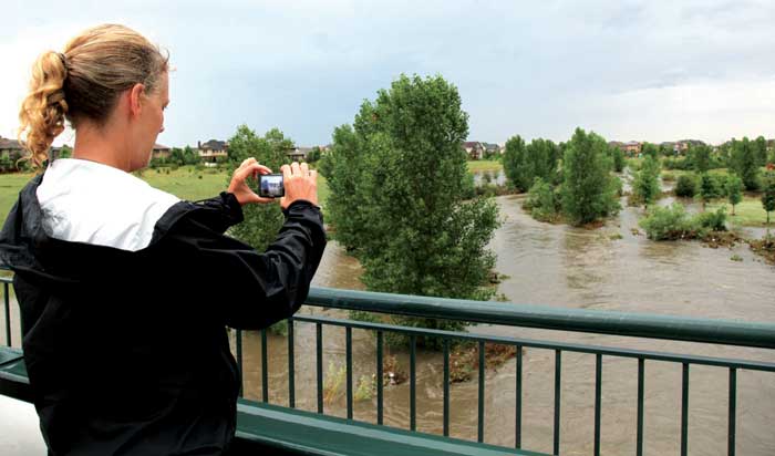
Kris Rasmussen takes a photo from the 26th Avenue bridge on July 7. Westerly Creek is flooded, but it’s doing it’s job keeping the water out of the neighborhood and channeling it into Sand Creek.



An impressive share! I’ve just forwarded this onto a co-worker who was conducting a little research on this. And he actually bought me breakfast because I found it for him… lol. So allow me to reword this…. Thanks for the meal!! But yeah, thanks for spending time to discuss this issue here on your web page.