
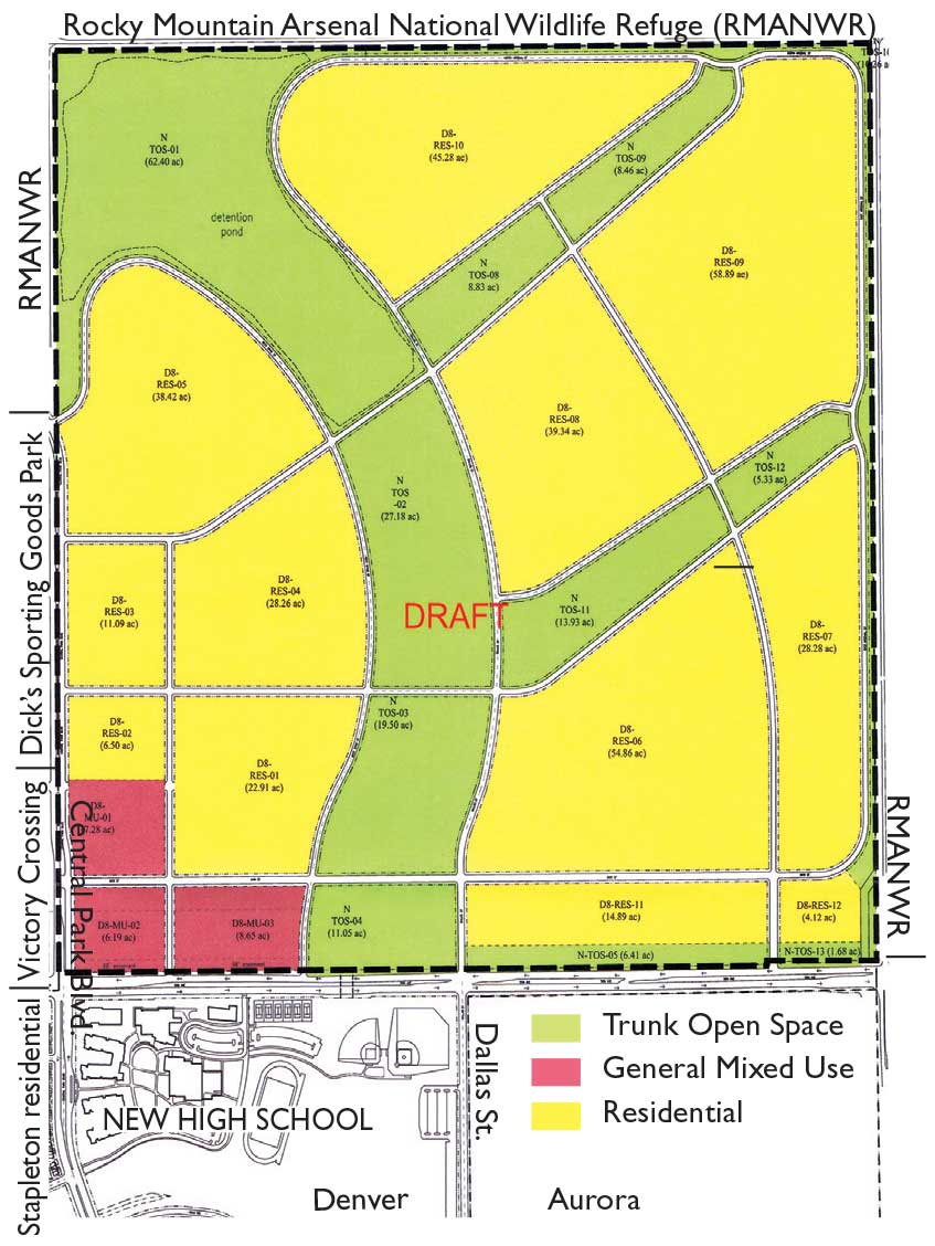
Forest City has submitted a preliminary General Development Plan (GDP) to the City of Denver for the last big undeveloped section of Stapleton land in Denver (the plan for the large Aurora parcel along 26th Ave. will be submitted to Aurora). Referred to as “Section 10,” the land is one square mile and has 175 acres of open space.
Deirdre Oss, Senior City Planner, explains that a GDP is a regulatory tool in Denver zoning code to address infrastructure and land use concepts for large projects, usually those that are 10 acres or more, and those that include the addition of streets that will be part of the city grid, the addition of stormwater drainage, and publicly accessible open space. The plans must comply with Denver’s open space requirements and must also meet the regional open space requirements in Forest City’s contract for Stapleton.
GDPs are reviewed for consistency with adopted plans that establish the city’s vision in areas such as land use, transportation and sustainability—and in this case, for consistency with the Green Book (the Stapleton Development Plan). Oss says GDPs typically show a framework for how residential will be developed (yellow areas on above map), which might include sustainability principles such as maximizing sunlight and transportation planning (creating arterial and connector streets and multi-modal connections within the neighborhood).
The plan will be sent out to get comments from agencies within the city and other entities such as DPS—and the city will hold a community meeting (likely in late June) to get public comments. The Stapleton Community Advisory Board (CAB) has already been providing feedback and has expressed concerns that although the detailed level of housing and parks plans aren’t determined at this stage, these broad land use plans can drive what’s possible later. CAB will continue to have the opportunity to review the plan as revisions are made and the public will be able to see revisions at DenverGov.org > Planning Department.